
A Historical Tour of Tims Ford Lake
Tims Ford Lake is awash in history. From the early Native Americans to inhabited the land to the farms and towns people who occupied the land before the lake filled.
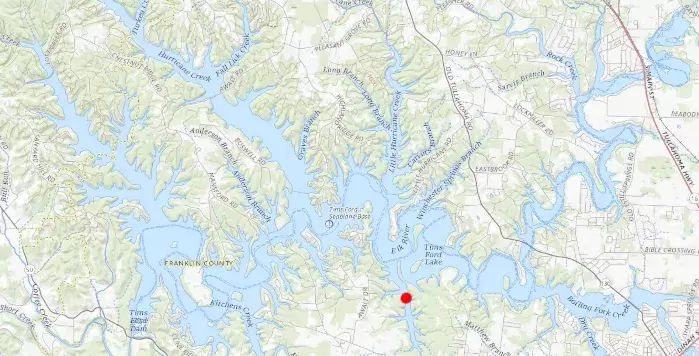
This article takes you on a journey through the history of the land under and displaced by Tims Ford Lake. You can view the below map to see where each of the unique places are, then scroll down to learn more about each of them.
Our Journey begins in the northeastern point of the Tims Ford Lake which is the Elk River water coming from the Woods Reservoir.
Bethpage Bridge by Tims Ford Lake
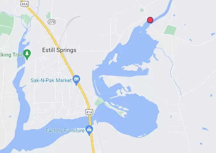
- Beginning in the far Northeast portion of the lake, in the waters below the Woods Reservoir, there's the old civil war era Bethpage Bridge (built mid-1800's) -- of which the foundation can still be seen adjacent to the current bridge. This bridge was used by Civil War Soldiers.
- There is a civil war cemetery just up the road from the bridge
- Beginning in the far Northeast portion of the lake, in the waters below the Woods Reservoir, there's the old civil war era Bethpage Bridge (built mid-1800's) -- of which the foundation can still be seen adjacent to the current bridge. This bridge was used by Civil War Soldiers.
Location of Bethpage Bridge on Tims Ford Lake Map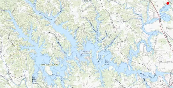
- Bethpage Bridge in Estill Springs TN
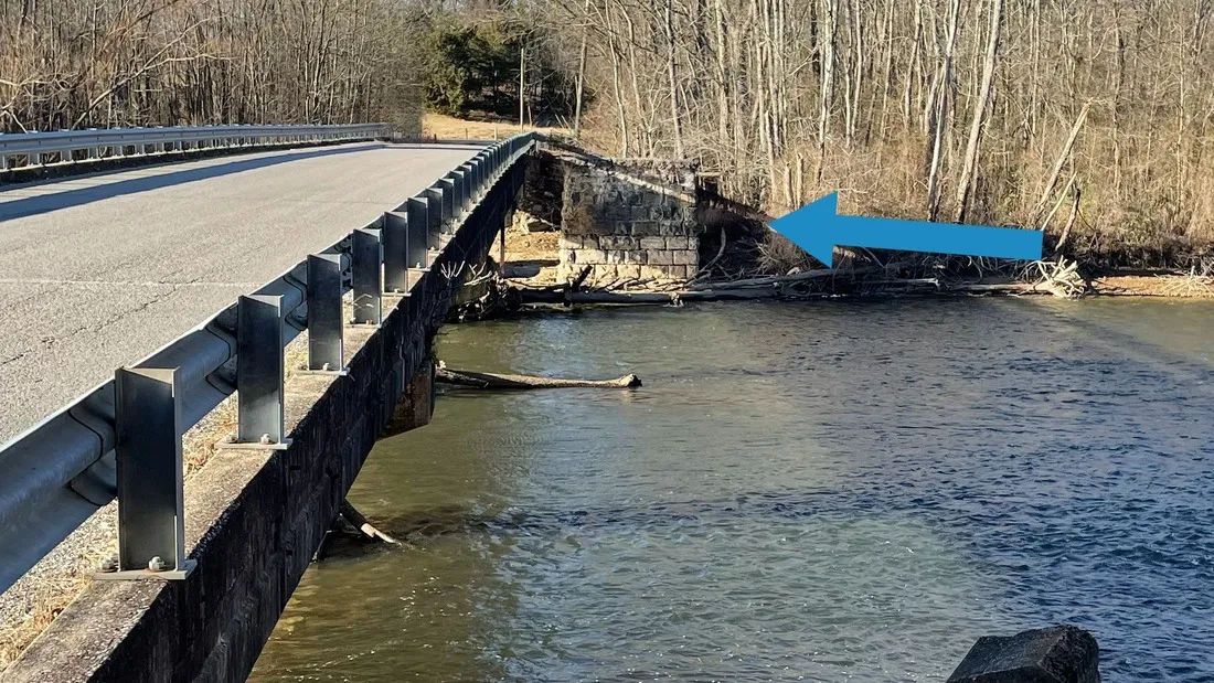
- Bethpage Bridge foundation on Elk River in Estill Springs
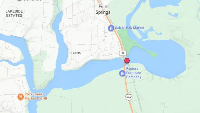
Estill Springs Power Plant on Tims Ford Lake
- The old Estill Springs Hydroelectric Powerplant was built on the foundation of the Estill Springs Mill which is the current Estill Springs City Park just by the baseball fields. The Mill was originally built in the later 1800's.
 The Old Estill Springs Mill
- Unfortunately the Mill burned down in 1912.
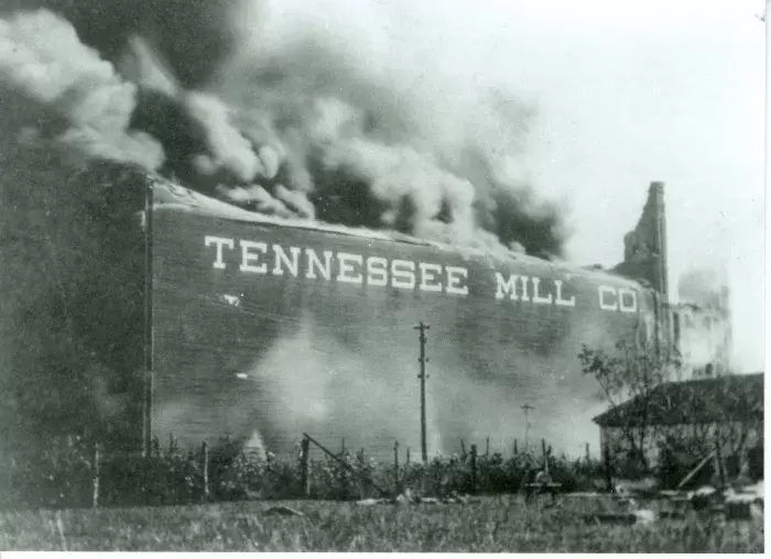 The Tennessee Mill Fire in 1912 from Estill Springs TN
- The powerplant was built in 1922 and was the second power plant on the Elk River (the Loop just below was #1 built in 1901).
- The plant used a dam across the Elk River to direct water into the power generation facility to provide hydroelectric power to the area. Looking in the below photos you can see both the remnants of the old Estill Springs Power Plant Dam as well as the foundations of the hydroelectric power plant. You can see both from the water and the ground above.
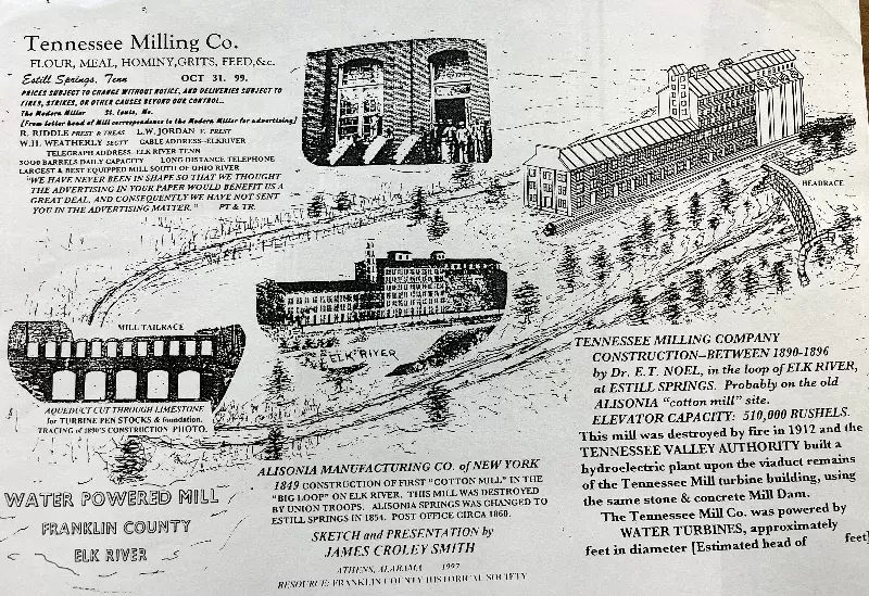
- From an article from Tennessee Tech:
The hydroelectric facility at Estill Springs was built on the site of the former Tennessee Milling Company, which had been demolished. In 1922, the Nashville firm of Foster & Creighton repurposed it into a power plant for the Southern Cities Power Company.
The dam, made of square masonry, was 14 feet wide at its base, 5 feet at the top, and spanned 300 feet across the Elk River. Drawing design inspiration from the nearby Loop Plant located 6 miles downstream, water was channeled to the hydroelectric generators through the Elk's narrow horseshoe bend. While the dam no longer exists, remnants of its abutments, an earthen embankment, stone masonry head and tail race facilities, and the power plant's foundation remain visible. The dam was demolished by the TVA in the 1960s to establish Tims Ford Lake.
- The powerplant was built in 1922 and was the second power plant on the Elk River (the Loop just below was #1 built in 1901).
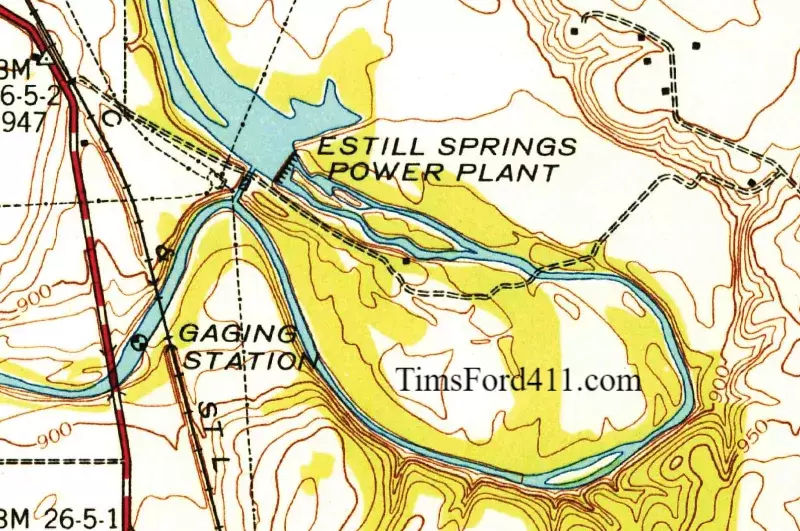 1942 Map - showing the Estill Springs Powerplant and Dam
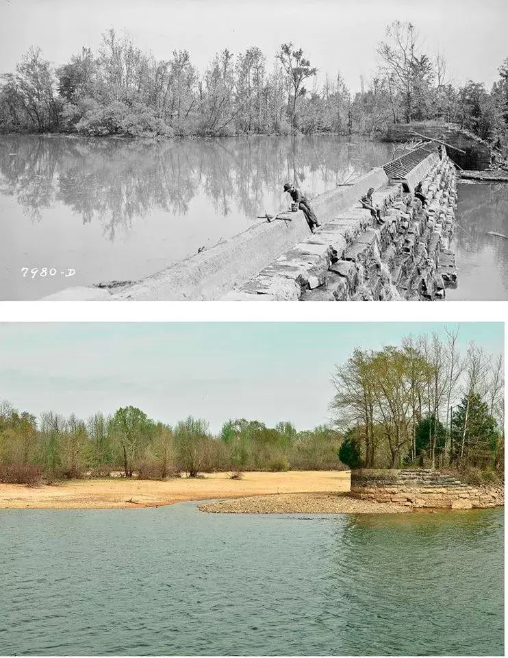
The Estill Springs Dam for Elk River -- now Tims Ford Lake - then and now
Alisonia Depot (Alisonia was renamed to Estill Springs
- Before Estill Springs became Estill Springs, it was known as Alisonia during the Civil War. Right off of TN41A there's a historical marker along the road identifying "Camp Harris" which was a Civil War era camp just adjacent to the Alisonia Railroad Depot. Alisonia Road connects to 41a!
- Camp Harris was named after the TN governor during the Civil War. This location is adjacent to the Tims Ford Lake Reservoir .
- Its interesting to note that the train bridge crossing the Elk River is in the same location as a civil war era train bridge (that was eventually replaced)
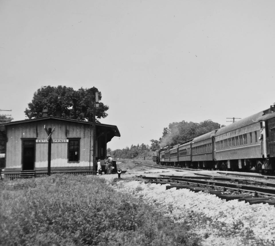 Alisonia and Now Estill Springs Train Depot adjacent to Tims Ford Lake
photo c: 1940's
- The first Estill Springs TN railroad bridge over the Elk River is below. This was eventually replaced by a newer bridge in the same location. The train depot was just over the train bridge in Estill Springs. The valley of the area in the photo is submerged by Tims Ford Lake.
- Check out the below photo from the mid-1800's
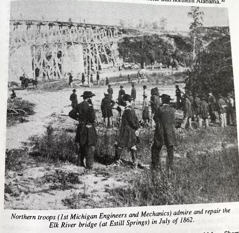 C1862 during the Civil War, the first Estill Springs Railroad Bridge over Elk River
Island Ford
- Island ford is one of the Fords you will pass as you go south that used to cross over the Elk River adjacent to the Rock Creek Ford. A ford is a way to pass over / through a river.
- Island ford is one of the Fords you will pass as you go south that used to cross over the Elk River adjacent to the Rock Creek Ford. A ford is a way to pass over / through a river.
Rock Creek Ford
- The Rock Creek ford crossed over Rock Creek by where the current Eastbrook Bridge is currently located. A ford is a way to pass over / through a river.
- The Rock Creek ford crossed over Rock Creek by where the current Eastbrook Bridge is currently located. A ford is a way to pass over / through a river.
The Loop Hydroelectric Powerplant
- The Loop Plant was developed in 1901 and was the first hydroelectric powerplant in Tennessee. This powerplant was a waterwheel driven plant that provided electricity to the town of Winchester. The plant was upgraded to provide additional power then eventually torn down in the 1920s. The Estill Springs Powerplant that is slightly upriver by a few miles then provided the power needed.
- The Loop Plant was developed in 1901 and was the first hydroelectric powerplant in Tennessee. This powerplant was a waterwheel driven plant that provided electricity to the town of Winchester. The plant was upgraded to provide additional power then eventually torn down in the 1920s. The Estill Springs Powerplant that is slightly upriver by a few miles then provided the power needed.
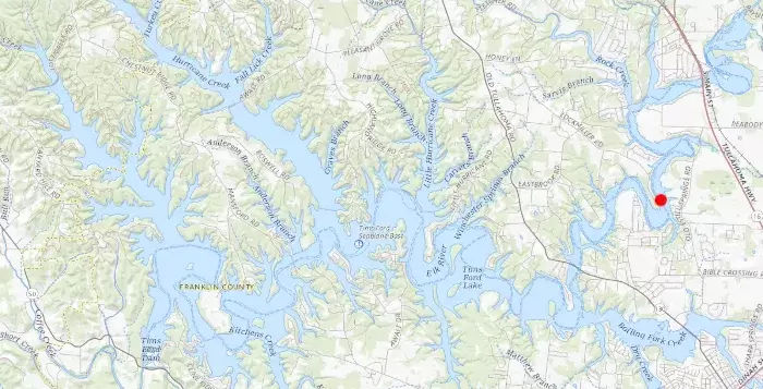
 Location of Loop Power Plant on Tims Ford Lake Map
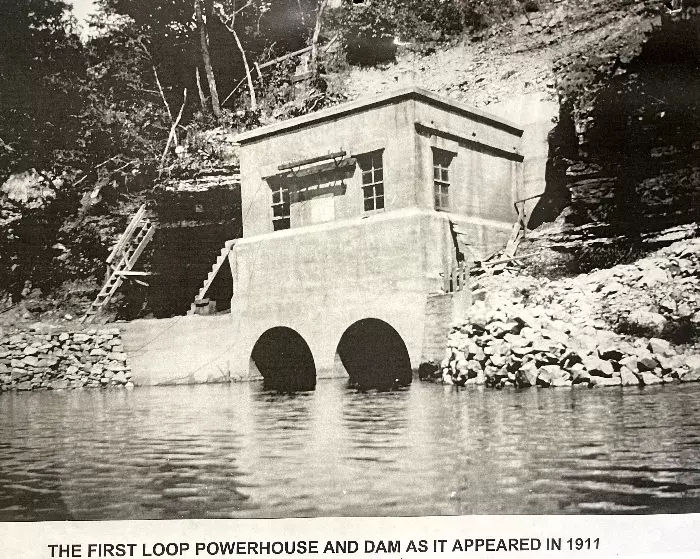
- From an article @ Tennessee Tech University:
Built on the Elk River, the "Loop Plant" was situated approximately 6 1/2 miles from the city and was inaugurated in 1901, marking the onset of the twentieth century. The plant featured a 20-foot high concrete dam in a river bend, or 'loop', giving it its name. A flume, a common feature in many Tennessee plants, was carved through rock to channel water to a powerhouse housing a 100-kilowatt generator powered by a grist mill-type waterwheel.
The uniquely designed split-level powerhouse was constructed on oak timbers laid atop a cut. Initially, the electricity demand was lower than expected, leading to reliance on a steam-powered plant in Winchester, primarily for street lighting. By 1909, as electricity consumption surged, the Loop Plant's capacity was enhanced.
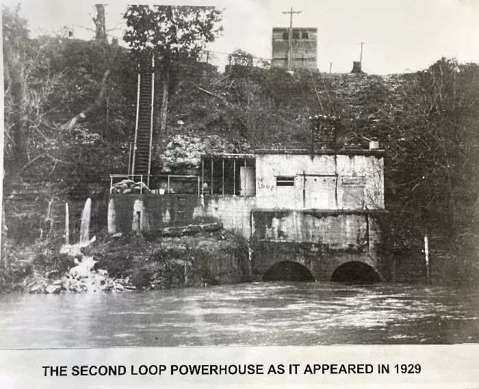
A 70-foot tunnel replaced the canal, reminiscent of Montgomery Bell's work on the Harpeth River a century prior. This tunnel led to a new concrete powerhouse with a 148-kilowatt generator, marking Tennessee's first hydro-electric unit of its kind. Concrete became a standard material for powerhouses, and the Loop Plant's design likely inspired larger projects across Middle Tennessee. The plant underwent several modifications, including new generators in 1909 and 1913, and faced challenges like the 1929 flood.
By 1930, due to high operational costs, the second Loop Plant was abandoned, its dam dismantled, and its remnants now lie beneath the TVA's Tims Ford Lake. 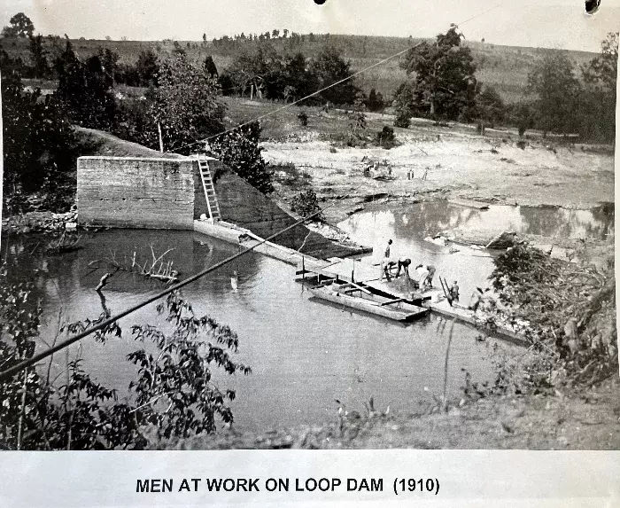
- From an article @ Tennessee Tech University:
The Second Loop Powerhouse was also filmed below the water by Matthew Gluch recently. See the photo below where the powerhouse building remains underwater to this day.

Lockmiller Bridge Under Tims Ford Lake
- Just a mile or two down the river from the Loop, is the Lockmiller Bridge by the Acklen Bend on Elk River. The Lockmiller bridge crossed the Elk River and connected to Lockmiller Road adjacent to Tims Ford Lake. This was a single lane bridge with wood planks similar to others in the early part of the 20th century (see the Lee's Ford Bridge photo below). Thee location of the bridge is similar to the current power lines that currently cross the river.
- Just a mile or two down the river from the Loop, is the Lockmiller Bridge by the Acklen Bend on Elk River. The Lockmiller bridge crossed the Elk River and connected to Lockmiller Road adjacent to Tims Ford Lake. This was a single lane bridge with wood planks similar to others in the early part of the 20th century (see the Lee's Ford Bridge photo below). Thee location of the bridge is similar to the current power lines that currently cross the river.
 Lockmiller Bridge now under Tims Ford Lake
 Location of Lockmiller Bridge on Tims Ford Lake Map
- The bridge connected to Lockmiller Road which no longer reaches the water. There is a sign at the end of the current Lockmiller Road (at a gate) saying that the property passed the gate is part of TVA.
c1936 map - Historic Lockmiller Bridge under Tims Ford Lake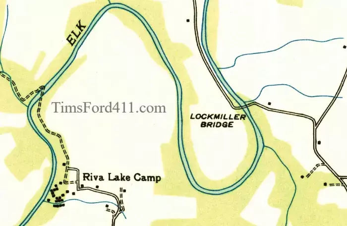
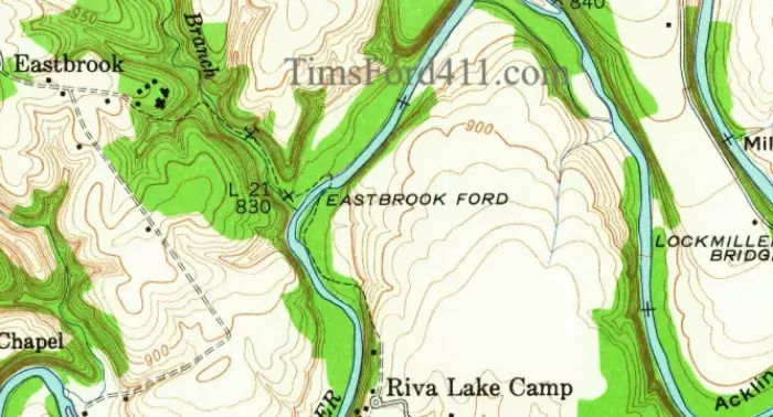
Eastbrook Ford
- Going south on the Elk River, you hit Eastbrook Ford that crossed the river and allowed passage to the town of Eastbrook TN.
- Eastbrook Ford on Tims Ford Lake
- Going south on the Elk River, you hit Eastbrook Ford that crossed the river and allowed passage to the town of Eastbrook TN.
Camp Elklore / Camp Tennessee
- Camp Elklore was a 400 acre boys camp located on the Elk River that opened in the summer of 1930 in Winchester TN.
- It was sold and renamed "Camp Tennessee For Boys" in 1956. At some point after 1966 the camp closed. Likely due to the filling of the Tims Ford Lake.

- Camp Elkore in Winchester TN
- Camp Elklore was a 400 acre boys camp located on the Elk River that opened in the summer of 1930 in Winchester TN.
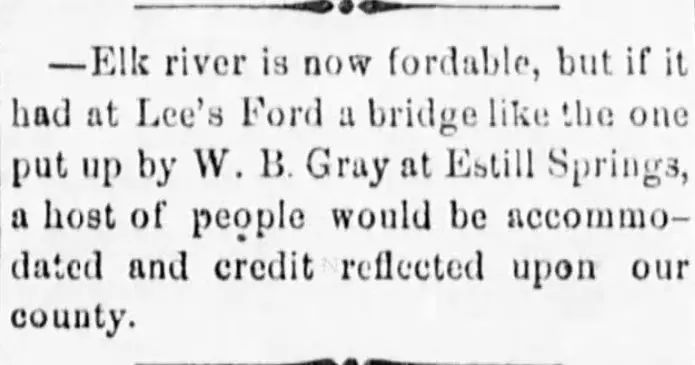
Lee's Ford Bridge
- Lee's Ford across the Elk River was created in the mid to late 1800's to be able to cross the river. The bridge was created in the late 1800's or very early 1900's.
 1879 - Home Journal ArticleLee's Ford across the Elk River (not a bridge yet)
- The Lee's Ford Bridge in Winchester TN crossed the Elk River right before it intersected with the Boiling Fork (close to Devil's Step Island). When the Tims Ford Lake was built, a new, higher bridge was built in its place allowing the Old Tullahoma Road to enter into Winchester TN.
- c1902 - Lee's Ford Bridge over the Elk River
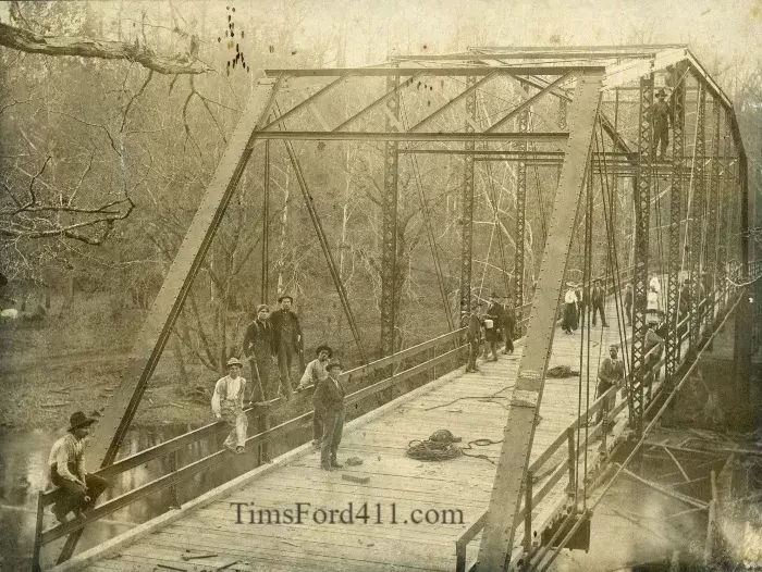
Owl Hollow Bridge Under Tims Ford Lake
- The Owl Hollow Bridge was located in the small town of Owl Hollow on the Elk River (now submerged by Tims Ford Lake). The bridge traversed across the Elk River.
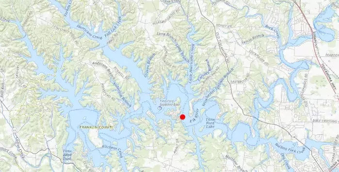
- Location of Owl Hollow Bridge on Tims Ford Lake Map
- The below map is an overlay showing both the early map depicting Owl Hollow Bridge and Owl Hollow and the current Tims Ford Lake Map.
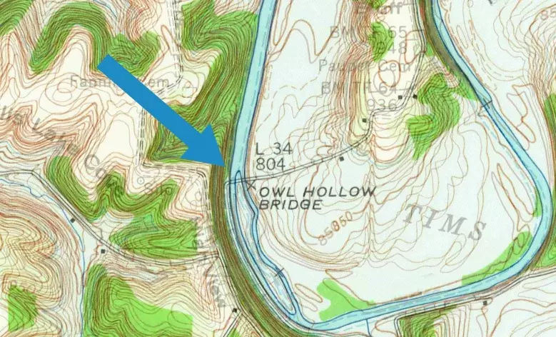
- 1947 map overlay on 1972 Lake Map showing Owl Hollow Bridge on Tims Ford Lake
Owl Hollow Bridge now submerged by Tims Ford Lake intact
photo: Steve Yarbrough- The below photo shows the now submerged Owl Hollow Bridge even with full grown trees next to it. The top of the bridge is still 60 feet under water with the tops of the trees under approx 40 feet of water. The middle of the bridge is on a small island in the middle of the river (see photo above and below)
- Lee's Ford across the Elk River was created in the mid to late 1800's to be able to cross the river. The bridge was created in the late 1800's or very early 1900's.
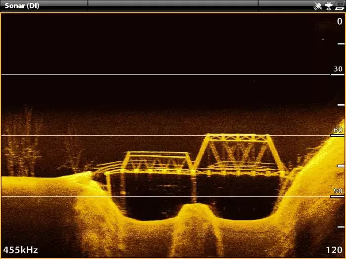
Sonar Picture of Owl Hollow Bridge under Tims Ford Lake
Photo: Steve Yarbrough
Owl Hollow Mill Under Tims Ford Lake
- Owl Hollow was a small town on the Elk River which is now under Tims Ford Lake. There were a few stores including a mill, church, school and homes. The church was moved to higher ground when the lake filled up.
 Location of Owl Hollow Mill on Tims Ford Lake Map
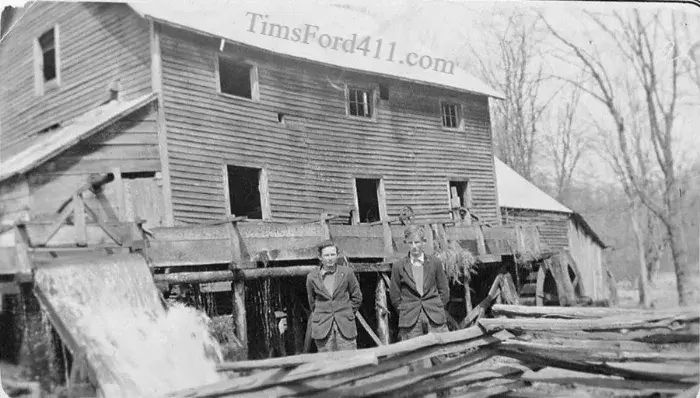 Owl Hollow Mill under Tims Ford Lake
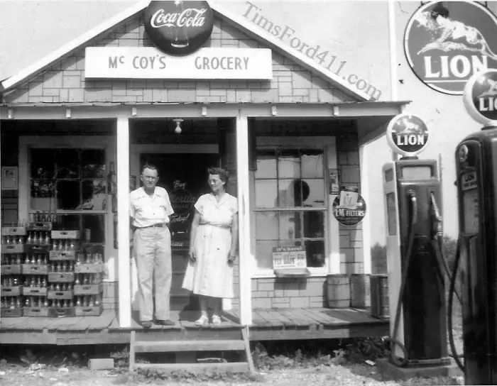
David McCoy's Store in Owl Hollow
c early 1900s
 Bethel Methodist Church in Owl Hollow early 1900s
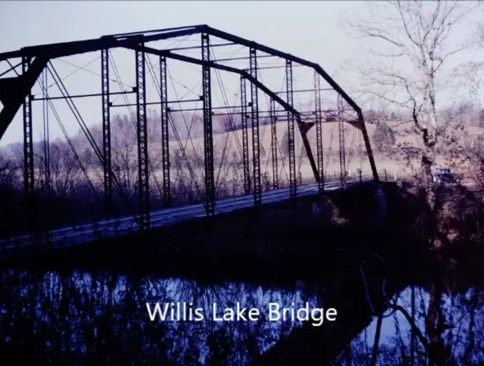
Willis Lake Bridge Under Tims Ford Lake
- Willis Lake Bridge under Tims Ford Lake is still fully intact though under about 60 feet of water

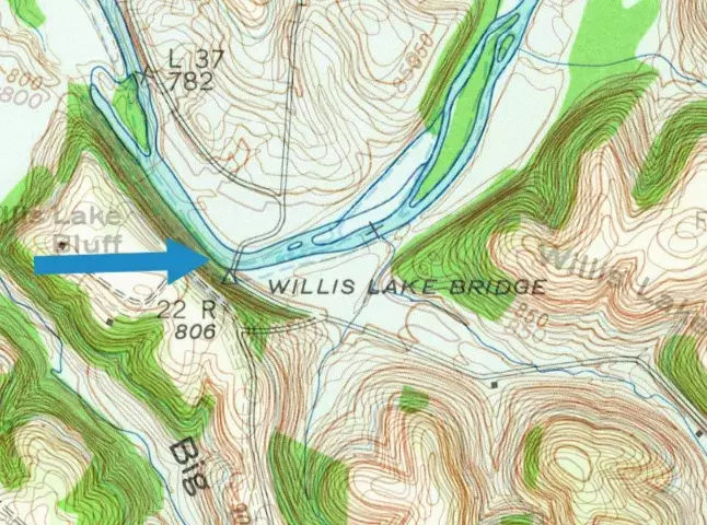
- Location of Willis Lake Bridge on Tims Ford Lake Map
- Willis Lake Bridge now Under Tims Ford Lake
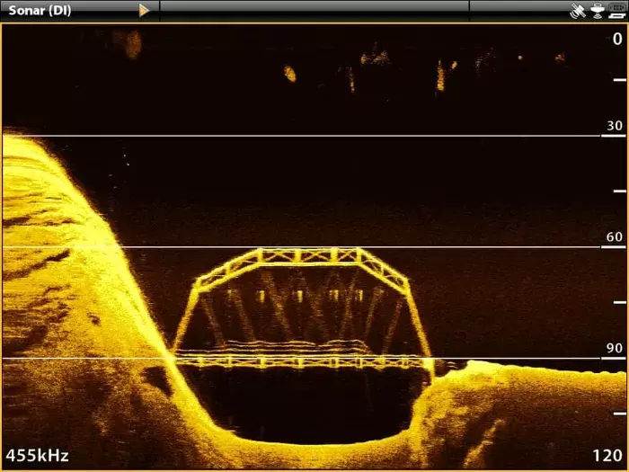 Sonar View of Willis Lake Bridge under Tims Ford Lake
photo: Steve Yarbrough- You Can see that the Willis Lake Bridge was actually only on the Elk River (not a lake) - it is just slightly south of Highland Ridge.
- Willis Lake Bridge going over the Elk River
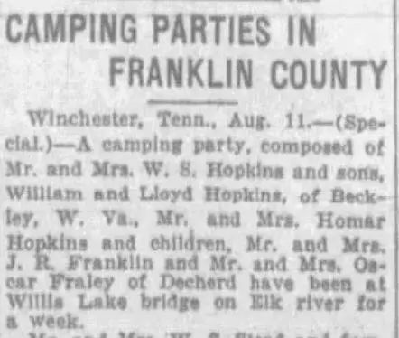
- Aug 1928 Nashville Banner Article about Willis Lake Bridge
City of Awalt, TN (now covered by Tims Ford Lake)
- Awalt was a small village in the Northwest portion of the Tims Ford Lake that was submerged when Tims Ford Lake filled in 1971. The location is very close to BlueGill Grill on Tims Ford Lake.
- The below Awalt photo is a merge of a historic photo with the roads in and out along with the current lake . It shows how the roads in and out of Awalt are all covered by the lake.
- See our article to learn more about Awalt TN
- Awalt was a small village in the Northwest portion of the Tims Ford Lake that was submerged when Tims Ford Lake filled in 1971. The location is very close to BlueGill Grill on Tims Ford Lake.
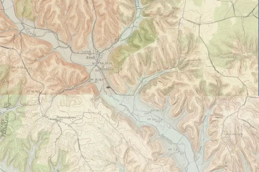
 Location of Awalt on The Tims Ford Lake Map
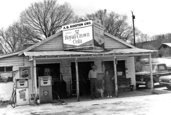 Awalt Town Store
TimsFord411.com -
The Ultimate Guide To The Tims Ford Lake Area
Business Listings || Weather / Weather Radar || Things to Do || Area Articles || Community Calendar
Winchester TN || Tullahoma TN || Lynchburg TN || Estill Springs TN || Decherd TN
TimsFord411.com is the ultimate guide to all things by the Tims Ford Lake Area. Find businesses, things to do, historical articles, local weather and weather radar, jobs, the lake level, a community calendar, and more. All in one single place. Business Owner? Make sure to claim your profile


Leave Comment Below